Devpost
Participate in our public hackathons
Devpost for Teams
Access your company's private hackathons
Grow your developer ecosystem and promote your platform
Drive innovation, collaboration, and retention within your organization
By use case
Blog
Insights into hackathon planning and participation
Customer stories
Inspiration from peers and other industry leaders
Planning guides
Best practices for planning online and in-person hackathons
Webinars & events
Upcoming events and on-demand recordings
Help desk
Common questions and support documentation
The Celestial Navigation system module uses stars and other bodies in space to help a UAV navigate if the current navigation system is influenced by a GNSS-degraded area or other physical factor.
Radio communication is jammed, and all backup solutions fail... avoid risking lives by sending encrypted information with sound.
Connection ports enabling the chaining of fiber optic drones, thus increasing their effective range.
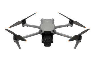
Battlefield Intelligence, Always Within Reach.
Drone communication is prone to jamming and interception. Every 5 minutes, drones change frequencies and deploy visual hash-coded signals (“depols”), which are read and decoded by a secure algorithm.
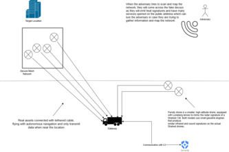
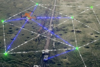
A mesh of small beacons is launched over a large area. Together they form a Local Positioning System that enables precise location and guides a resupply robot when GNSS and networks are down.
NEURMORPHIC INTELLIGENCE FOR SMARTER SECURITY
Hop! - Radio Communications Modules with Hopping to be installed in UGVs and relay units (drones). The solution is EW resistant, landscape resistant and affordable.
“Making nodes disappear from the attack map.”
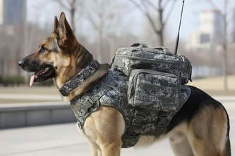
Navigation for dogs which will help them bring medicine for soldiers.
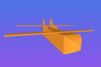
A cargo glider that can be airdropped from a safe distance to deliver supplies in contested environments.
SavePath — connecting civilians, responders, and command centers to save lives when every second counts.
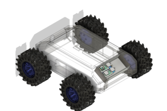
We deliver modular field drone solutions, providing mission‑grade frames customized to varied specs, boosting front-line capability while cutting transport and logistics burden.
AI-powered, real-time fact-checking and evidence-traceability for YouTube video intelligence - designed for defence analysts and operational teams.
We build an app to get your coordinates just by photographing the sun!
Minesweep is an AI-powered mapping platform that analyzes multi-sensor drone data to detect and map landmines automatically, reducing human risk and speeding up clearance operations.
Aiming to detect UAVs in the field without getting support from radar signals
A smart watch/band used for finding civilians or military personnel in wreckages and in the field by tracking vital signs, primarily utilizing UWB and LoRaWAN communication
Locanex delivers a GNSS replacement for denied environments—a modern digital VOR providing encrypted, resilient beacon navigation for drones and autonomous systems anywhere.
AtlasRay uses drone and satellite data to map hazardous or unknown terrains, detecting obstacles, contamination zones, and hidden threats for safer, faster mobility planning.
1 – 20 of 20